HalleTreecrowns – An interactive map for modelled trees in Halle / Saale, DE
Webapp: https://map.deeptrees.de
Maintainers: Taimur Khan (Bzf.) and Jörg Brünecke(Bzf.), Helmholtz-UFZ
Code Repository (internal only): https://git.ufz.de/khant/halle-treecrowns
Contact: taimur.khan@ufz.de
Introduction
Tree-crown detection is a challenging task, as tree crowns can vary significantly in size, shape, and texture. Deep Learning can overcome these challenges by learning complex features from large amounts of annotated data, allowing to accurately detect tree-crowns even in highly variable images. Thus making the task efficient, cost-effective and reproducible.
Some of the key benefits to this method include:
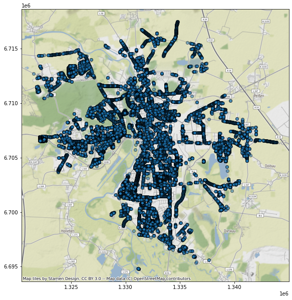
Deep learning-based tree-crown detection provides a highly efficient and automated approach compared to traditional manual methods (i.e. field work). By detecting individual tree-crowns, deep learning models can estimate tree parameters such as height, diameter, and volume, which are crucial for accurate carbon calculations [4]. Thus, allowing to extract valuable information related to carbon sequestration and climate change. Detecting individual tree-crowns aids in various applications beyond forestry. Urban planning, environmental impact assessments, and habitat monitoring can all benefit from detailed tree-crown information. The city of Halle (Saale), Germany, maintains a city tree inventory, known as the “Halle Baumkataster” [1]. The inventory data has been collected through years of field work to map 40.011 individual trees in the city (Figure 1). We applied a deep learning model called DeepForest [5] to 20 cm public digital orthoimagery (DOP20) [2] to detect individual tree-crowns from the DOP20 imagery in Halle and cross-validated the predictions with the Halle Baumkataster. DeepForest is a python package that abstracts PyTorch computer vision tooling and the RetinaNet deep learning model (based on Focal Loss for Dense Object Detection [3]).
The model detected 870,343 tree crowns in Halle, with 51 percent of the Baumkataster data overlapping with these predictions (Table 1). These results can be further improved with a larger training dataset and higher resolution orthoimages (DOP10) from the state of Sachsen-Anhalt. The model can also be extended to the wider area of Sachsen-Anhalt as the DOP imagery is publicly available for this area. Only a model training dataset would be needed for such a scaled solution.
The results and data (training and predictions) of this study are publicly available via a web-based user-interface created specifically for the city of Halle.
| Modelled Tree Count | Baumkataster Tree Count | Overlap(%) |
|---|---|---|
| 870.343 | 40.011 | 51,71 |
Open Datasets
Download folder: https://syncandshare.desy.de/index.php/s/XKrLBe5ySW6bjet
References
Halle Baumkataster: https://konservatorium.halle.de/de/Verwaltung/Umwelt/Umweltatlas/Naturschutz/Stadtbaeume-Baumkataster/
Halle DOP20: © GeoBasis-DE / LVermGeo ST” [2022]. The terms of use of LVermGeo ST apply.
Lin, Tsung-Yi, et al. “Focal loss for dense object detection.” Proceedings of the IEEE international conference on computer vision. 2017.
Schmucker, Julia, et al. “Crown allometry and growing space requirements of four rare domestic tree species compared to oak and beech: implications for adaptive forest management.” European Journal of Forest Research 141.4 (2022): 587-604.
Weinstein, Ben G., et al. “Individual tree-crown detection in RGB imagery using semi-supervised deep learning neural networks.” Remote Sensing 11.11 (2019): 1309.